
NOAA Winter Outlook 2026–27: What El Niño Means for Rain and Snow
If NOAA’s map says my area is likely to be wetter than normal, does that mean my town will get more snow? Not necessarily. NOAA favors a warmer winter across much of the northern U.S. and a wetter winter in California and the Southeast. The maps show the odds for December through February. Neither gives a snowfall total for your town.
How to read NOAA’s two winter maps
Find your region on both maps. NOAA compares each location with its own winters from 1991 to 2020. The temperature map uses the three-month average. The precipitation map adds up all the water that falls during those months.
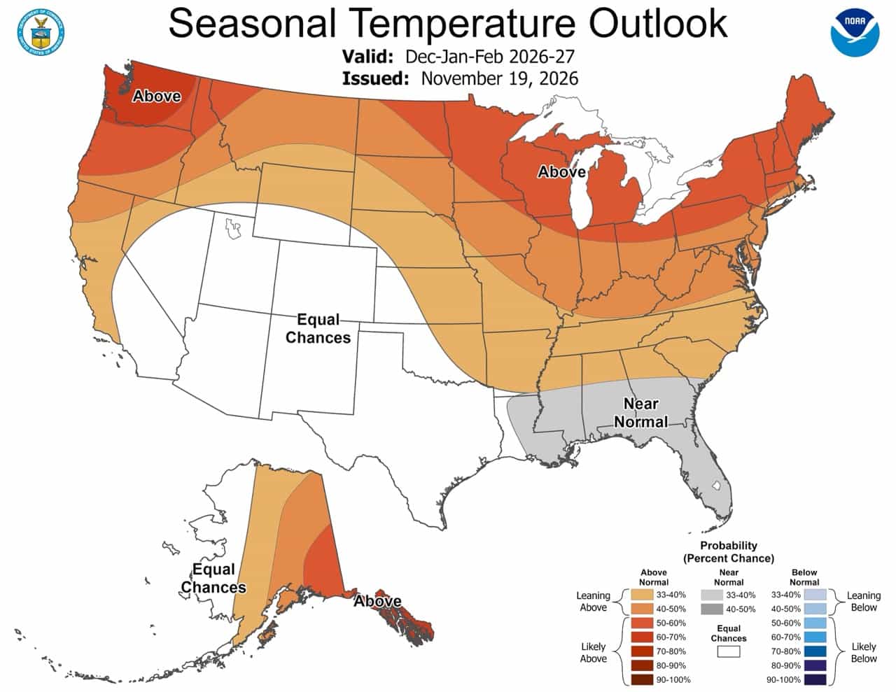
Much of the northern two-thirds of the contiguous U.S. leans warm. The chance of a winter in the warmest third exceeds 50% across much of the Great Lakes, Northeast, and Pacific Northwest.
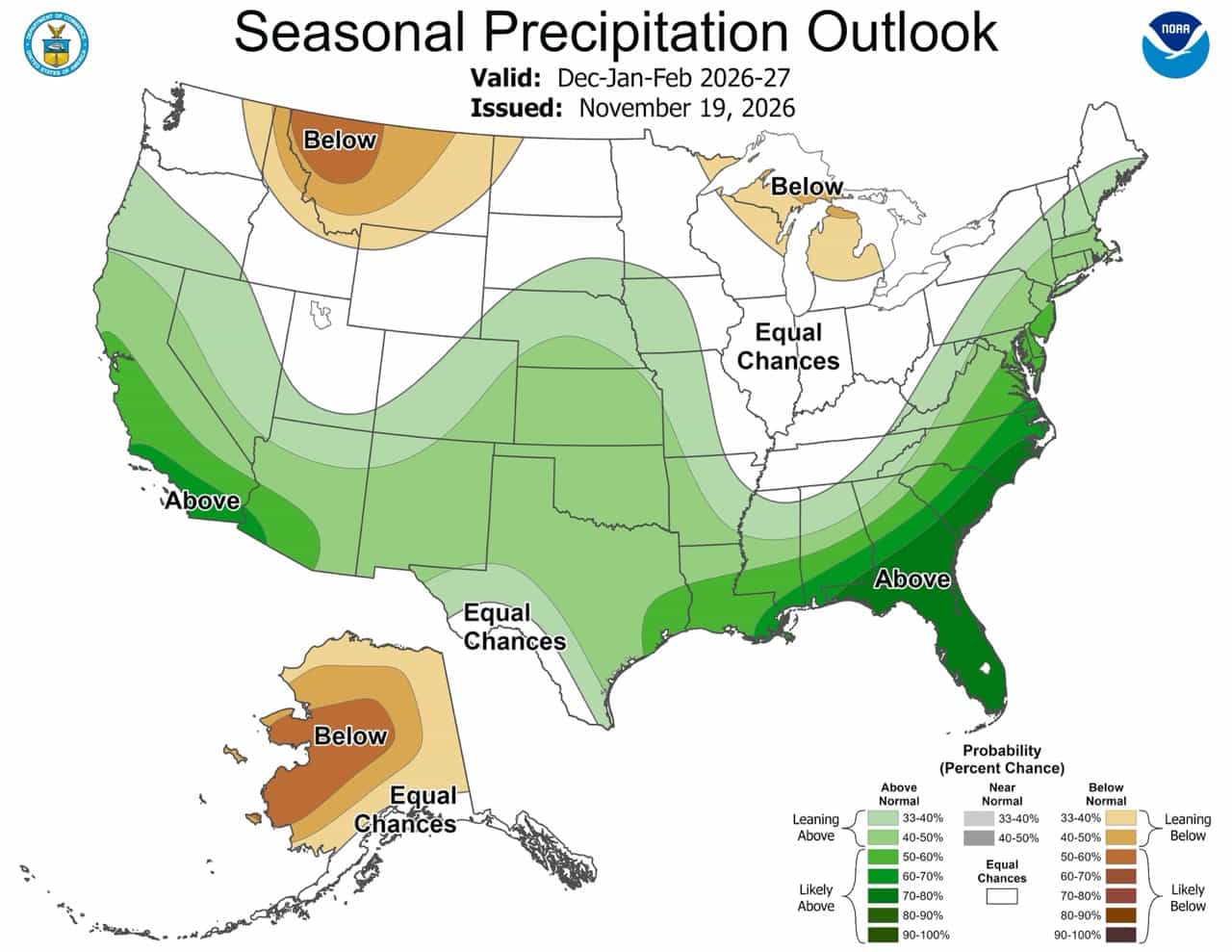
California and much of the Southeast lean wet. The odds exceed 70% in Florida, southern Georgia, and the coastal Carolinas. Parts of the northern Rockies and Great Lakes lean dry.
What does 70% mean? At a location with a 70% chance of above-normal precipitation, the winter has a seven-in-ten chance of finishing in the wettest third of the historical range. The percentage tells you how likely that outcome is. It doesn’t tell you how many extra inches will fall.
Why El Niño can bring rain to one town and snow to another
During El Niño, warmer water in the tropical Pacific can shift the Pacific jet stream south, steering more storms across the southern U.S. A storm reaching California can bring rain to a valley and snow higher in the Sierra Nevada. The elevation where rain turns to snow depends on how cold the air is during that storm.
La Crosse, Wisconsin, offers a real example. In the National Weather Service’s review of nine strong or very strong El Niño winters since 1949–50, six finished in the wettest third for December through February. Yet seven of the nine corresponding July-to-June snow seasons fell short of the local snowfall normal of 46.3 inches. Those records cover different periods and measure different things.



0 Comments